Waimea Canyon Drive: The Route 550 Guide
Everything about the drive up to the Grand Canyon of the Pacific: the road itself, the stops worth pulling over for, how long it takes from every corner of Kauai, and when to leave.
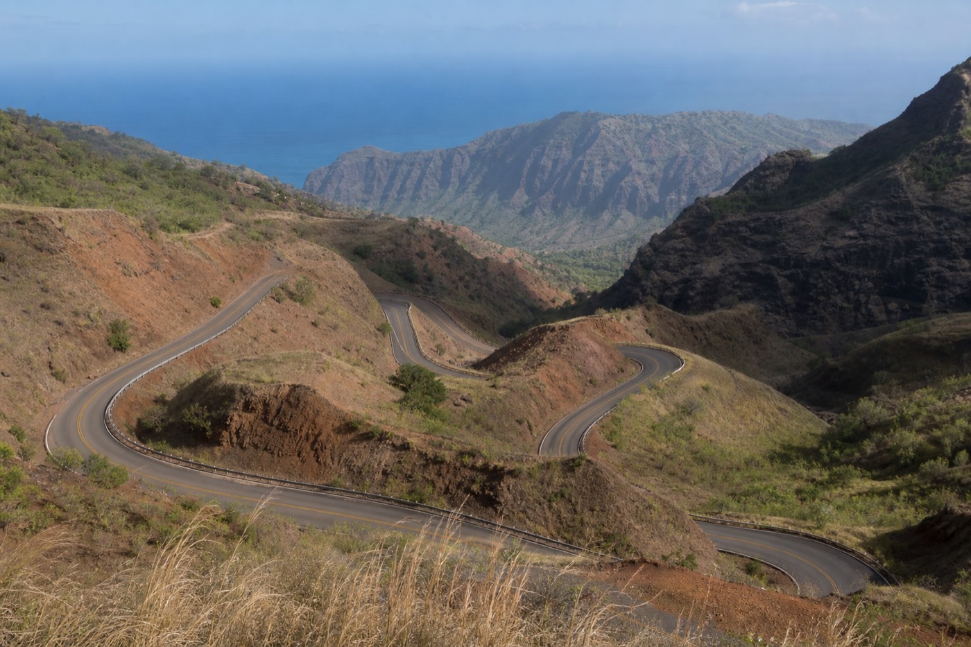
The road that carries you into Waimea Canyon is a two-lane ribbon of asphalt that climbs from sea level to roughly 4,000 feet in under twenty miles. It has a name most maps use, Route 550, and a personality that surprises first-timers: warm and dry at the bottom, cool and often misted at the top, with a canyon 3,500 to 4,000 feet deep opening up on your right as you gain height. This guide walks the whole drive from the coast to the last lookout, so you know what the road is like, where to stop, how long to allow, and when to leave your hotel.
Booking choice: Hear Hawaiian history and geology as offline GPS narration follows your own canyon drive. Explore Waimea Canyon Offline Audio Drive
How Do You Drive To Waimea Canyon?
Follow Kaumualiʻi Highway (Route 50) west along the coast to Waimea town, then turn inland onto Waimea Canyon Drive, which is Route 550. From there a single paved road climbs the canyon rim past every major lookout and continues into Kōkeʻe State Park to the end of the road at about 4,000 feet.
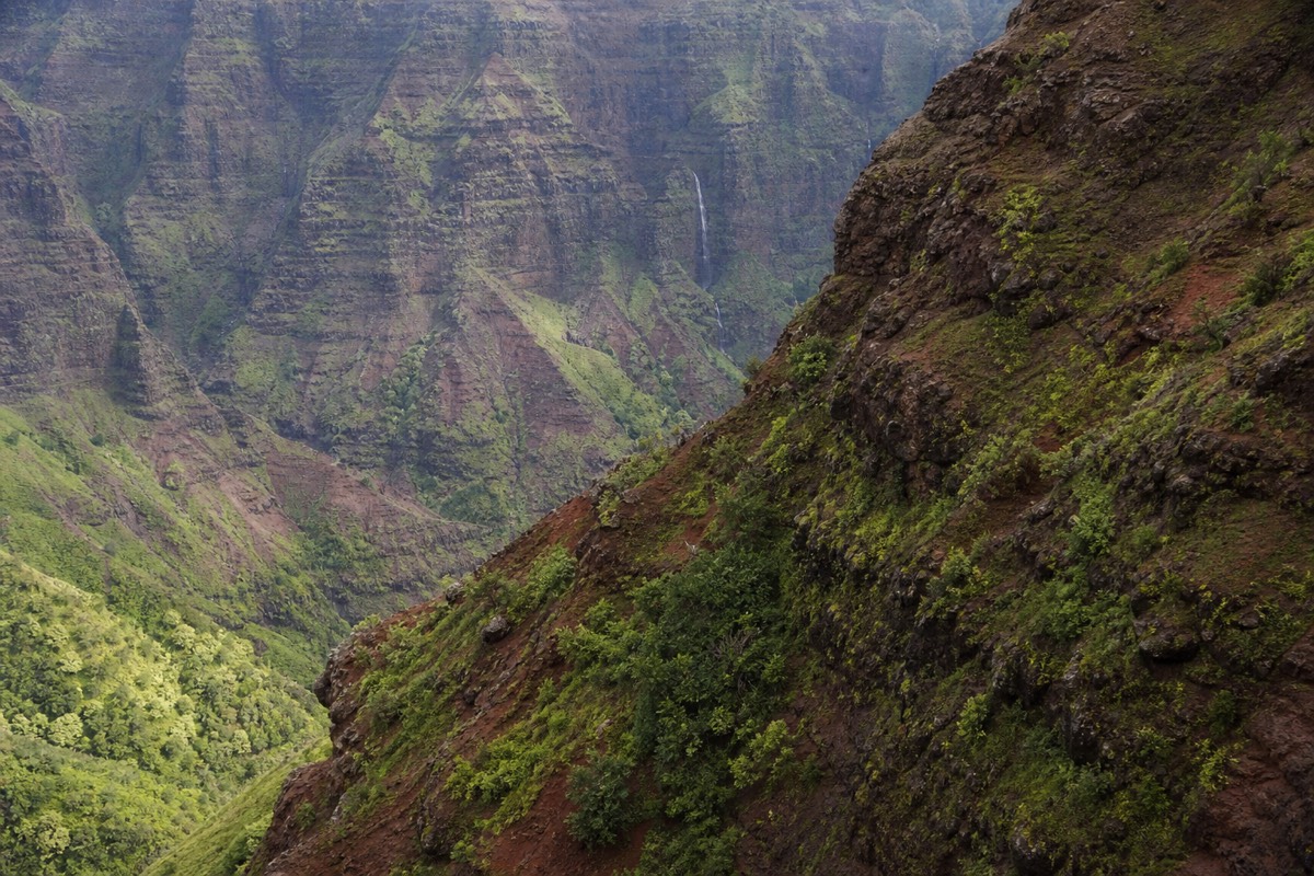
There is no confusing tangle of turns. The whole west side funnels traffic onto one coastal highway, Route 50, and the canyon has essentially one way up. When you reach Waimea town, a signed junction sends you mauka, the Hawaiian word for inland or toward the mountains, and the climb begins. A second connector, Kōkeʻe Road (Route 552), starts a little farther west in Kekaha and joins Route 550 near mile 7. Most visitors take Route 550 the whole way up for the canyon overlooks, and some come back down the Kekaha side to vary the view.
Fill your tank before you turn off the coast. There is no gas, no store, and no reliable phone signal on the mountain, so top up in Waimea or Kekaha and bring water. If you would rather not drive it at all, a guided Waimea Canyon Tour handles the wheel, the fees, and the timing for you, which we cover below and in our comparison of a guided tour instead of self-driving.
One more orientation point before you set off. Getting to Waimea town is the easy part, since Route 50 is a straight coastal run with clear signs. The character of the trip changes the moment you turn inland: the road narrows, the curves tighten, and you begin trading warm coastal air for the cooler heights. Set your expectations for a mountain drive rather than a beach cruise, and the climb feels exactly right.
What Is Route 550, And Where Does It Start?
Route 550, signed as Waimea Canyon Drive, begins in Waimea town off Route 50 and runs about 18 to 19 miles to Puʻu o Kila Lookout at the end of the road. Route 552 (Kōkeʻe Road) is a parallel connector from Kekaha that merges into Route 550 partway up. Both are fully paved public state highways.

People use the names Route 550, Highway 550, and Waimea Canyon Drive interchangeably, and they all mean the same road. It is the artery of the canyon. As you climb, mile markers count upward, and the important lookouts line up in a tidy sequence you can plan around. The lower half has the tightest curves and switchbacks as the road gains altitude quickly, and the upper half straightens somewhat as it rolls through Kōkeʻe's upland forest.
The junction with Route 552 near mile 7 is worth knowing about because it gives you options. Up one side and down the other turns the drive into a small loop with fresh scenery both ways. Either road delivers you to the same lookouts, so pick Route 550 from Waimea for the classic canyon reveal and treat 552 as a scenic alternative.
Is The Road To Waimea Canyon Paved? Is It Scary?
Yes, Route 550 is paved the entire way, two lanes with a painted center line and guardrails on the steeper drop-offs. It is winding, with switchbacks and some narrow stretches, but it is a normal maintained mountain road. Drivers comfortable on a hilly two-lane highway handle it fine at a relaxed pace.
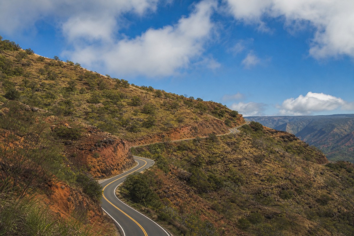
The word most first-timers reach for is winding, not dangerous. The lower switchbacks ask you to slow down and take curves deliberately, and there are places where the shoulder is thin and the canyon falls away on one side. None of it requires special skill. Keep to the speed the curves allow, use pullouts to let faster local traffic pass, and you will find the drive relaxing rather than tense.
Two honest cautions. The road can be foggy near the top, which we cover in its own section, so visibility is the real variable rather than the pavement. And the switchbacks can trigger motion sickness in passengers who are prone to it, so anyone sensitive should ride up front, look at the horizon, and consider skipping a heavy breakfast. Here is the road at a glance.
| Road feature | What to expect |
|---|---|
| Surface | Paved and maintained the full length, coast to Puʻu o Kila |
| Lanes | Two, one in each direction, painted center line |
| Curves | Frequent switchbacks on the lower half; gentler up top |
| Guardrails | Present on the steeper drop-offs, not continuous |
| Cell service | Patchy at the base, effectively none up the canyon |
| Gas and food | None on the mountain; last stop is Waimea or Kekaha |
| Restrooms | At the main lookouts and in Kōkeʻe State Park |
Do You Need A 4WD, Or Will A Regular Rental Car Do?
A regular rental car is all you need. Every major lookout sits on paved Route 550, so an economy car, sedan, or standard SUV reaches them without trouble. Four-wheel drive only matters if you plan to leave the highway for the unpaved canyon-floor tracks or the rough road to Polihale Beach, which are separate trips.
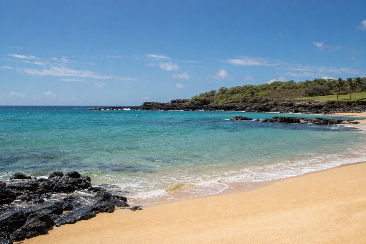
This is the single most common worry we hear, and the answer is reassuring. The canyon lookouts, Kōkeʻe, and the end-of-road viewpoints are all on sealed pavement. Rental companies on Kauai often warn that their contracts do not cover unpaved roads, and that warning is about places like the dirt tracks below the rim and the sandy approach to Polihale, not about the drive to the overlooks. For the classic canyon day, any car in the lot works.
If you are choosing a vehicle anyway, comfort matters more than capability. A car with decent air conditioning is pleasant on the warm coast, and something with a bit of ground clearance feels steady on the curves, but neither is required. Here is how the common rental options stack up.
| Vehicle | Handles the paved canyon road? | Notes |
|---|---|---|
| Economy or compact | Yes | Fine on every lookout; easy to park |
| Midsize sedan | Yes | Comfortable and stable on the switchbacks |
| Standard SUV | Yes | Good visibility over the guardrails |
| Convertible | Yes | Great views, but strong sun and wind up top |
| 4WD off-road vehicle | Not needed | Only for the unpaved side tracks and Polihale |
What Are The Best Stops Along The Drive?
The four essentials are Waimea Canyon Lookout around mile 10 for the signature panorama, Puʻu Hinahina near mile 13 for canyon-and-ocean views, Kalalau Lookout near mile 18 for the drop down Kalalau Valley to the Nā Pali Coast, and Puʻu o Kila at the end of the road. Kōkeʻe State Park sits between them with trails, a museum, and restrooms.
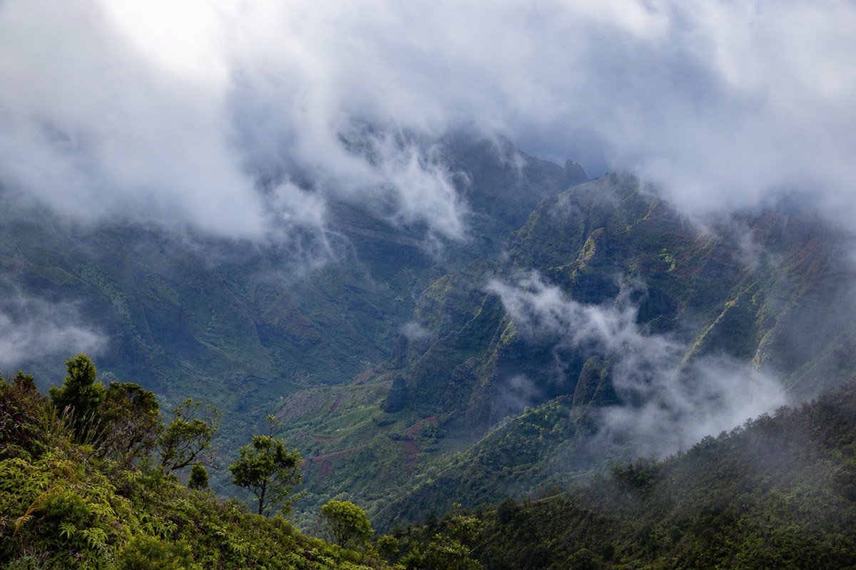
The drive rewards patience because the views change as you climb. Lower pullouts give you your first glimpses into the gorge, then the two big canyon overlooks show the red-and-green walls that earned the nickname Grand Canyon of the Pacific. Keep going and the scenery shifts entirely: past the canyon rim you enter cool forest, and the final two lookouts turn away from the canyon toward the fluted sea cliffs of the north shore. For a deeper tour of each viewpoint, see our roundup of the best canyon lookouts, and for the grand finale read the Kalalau Lookout guide.
Below is a stop-by-stop itinerary you can drive top to bottom in a half day, or stretch into a full day if you add a hike. Mile markers are approximate; the point is the order and the character of each stop.
| Approx. mile | Stop | What you see | Time to allow |
|---|---|---|---|
| 6 to 7 | Lower pullouts / Route 552 junction | First framed glimpses into the canyon | 5 to 10 min |
| 10 | Waimea Canyon Lookout | The signature panorama; Waipoʻo Falls in the distance | 20 to 30 min |
| 13 | Puʻu Hinahina Lookout | Deep canyon walls and, on clear days, Niʻihau island | 15 to 20 min |
| 15 to 16 | Kōkeʻe State Park (museum, lodge, trailheads) | Native forest, restrooms, food, birdlife | 30 to 60 min |
| 18 | Kalalau Lookout (~4,000 ft) | The view down Kalalau Valley to the Nā Pali Coast | 20 to 30 min |
| 19 | Puʻu o Kila Lookout (end of road) | More Nā Pali cliffs and the Pihea trailhead | 15 to 20 min |
If waterfalls are your priority, the best-known one is Waipoʻo Falls, visible as a thin ribbon from the main canyon overlook and reachable on foot for those who want a closer look. That hike gets its own treatment in our the trail to Waipoʻo Falls guide.
A word on pacing the stops. You do not have to do all six, and trying to can leave you rushed. If time is short, prioritize the main Waimea Canyon Lookout for the canyon itself and Kalalau for the Nā Pali view, since those two capture the whole range of what the drive offers. Puʻu Hinahina and Kōkeʻe make a wonderful day fuller, but they are the ones to trim if the clock or the weather closes in.
How Long Is The Drive From Lihue, Poʻipū, Princeville And Kapaʻa?
Allow about 40 minutes from Poʻipū or Lihue just to reach Waimea town at the base, then add roughly 45 minutes to climb to the top lookouts. From Kapaʻa allow around an hour and 40 minutes total, and from Princeville on the north shore closer to two and a quarter hours each way.
Kauai is small, but the canyon lives in its far southwest corner, so where you sleep changes your morning a lot. The south-side resort areas are closest, the east side adds commuter traffic, and the north shore is a genuine road trip. These are planning allowances rather than promises: leave earlier than you think, because the payoff for beating the clouds and the parking crush is large.
| Starting point | To Waimea town (canyon base) | To the top lookouts | Notes |
|---|---|---|---|
| Poʻipū / Kōloa | ~35 to 40 min | ~1 hr 20 min | Closest resort area to the west side |
| Lihue | ~40 min | ~1 hr 25 min | Straight west on Route 50 |
| Kapaʻa | ~50 to 55 min | ~1 hr 40 min | East shore; add time for morning traffic |
| Princeville / Hanalei | ~1 hr 30 min | ~2 hr 15 min | North shore; the longest haul each way |
One practical note for north-shore guests: a canyon day from Princeville is four to five hours of driving round trip on top of the sightseeing, which is a lot. Many travelers based up north decide the day is easier as a guided pickup, or they see the canyon from the air on a scenic flight instead, so the whole west side becomes someone else's drive.
Where Do You Park At The Lookouts And At Kalalau?
Each main lookout has its own lot, and the state park charges non-residents about $10 to park plus roughly $5 per person to enter, with one ticket covering both Waimea Canyon and Kōkeʻe. The shared lot at Kalalau and Puʻu o Kila at the end of the road fills earliest, often by mid-morning, so time your visit accordingly.
Parking is straightforward but finite. The two big canyon overlooks have paved lots that turn over steadily through the morning. Kōkeʻe's day-use area near the museum and lodge is the roomiest. The tightest squeeze is the very end of the road, where Kalalau and Puʻu o Kila share one lot, and that is exactly where everyone wants to be for the Nā Pali view, so it is the first to overflow. Arriving before the tour vans is the trick.
| Lookout | Parking | Fee | When it fills |
|---|---|---|---|
| Waimea Canyon Lookout | Paved lot | Covered by your park ticket | Steadily from mid-morning |
| Puʻu Hinahina | Small lot | Included | Rarely full |
| Kōkeʻe State Park | Large day-use lot | Included | Around midday |
| Kalalau / Puʻu o Kila | Shared lot at road's end | Included | Earliest, often by 9 to 10 a.m. |
You pay once and the ticket covers both parks for the day, so keep it on the dash. Full detail on what those fees buy and how residents differ lives in our post on seeing the canyon without a rental car and in the pricing breakdown further down the site.
What Is It Like Driving In Rain And Fog?
The upper canyon sits beside one of the wettest spots on earth, so mist and passing showers are normal, especially by afternoon. Rain rarely closes the road, but fog can erase the views and shorten sight lines. Slow down, switch on low beams, keep back from the car ahead, and use the lookouts to wait out a cloud.
Weather up here is a mood that changes by the hour. A clear coast can sit under a warm sun while the top lookouts vanish into cloud, and the reverse happens too, with a soggy morning burning off into a bright rim by late morning. The practical effect on driving is visibility, not traction: the pavement handles rain well, but a thick bank of fog near Kalalau can drop your view of the road to a car length or two.
Treat fog as a cue to ease off. Turn on headlights so oncoming traffic sees you around the curves, take the switchbacks gently, and if a lookout is completely socked in, give it twenty minutes. Clouds here move fast, and a gap often opens. If your day is fixed and the top refuses to clear, the lower canyon overlook usually holds a view even when Kalalau does not, which is worth knowing when you plan the best time of day to go.
Rain also changes the canyon in ways worth appreciating rather than dreading. Showers feed the thin waterfalls that streak the red walls, and the mist rising off the floor is what conjures the rainbows the west side is known for. A drizzly morning that clears by ten can hand you the most dramatic light of the day. So pack a light rain layer, keep the wipers handy, and think of the weather as part of the show instead of a spoiler.
Is The Drive Okay With Kids And Seniors?
Yes for most families and older travelers. The lookouts are short, mostly level walks from the parking lots, several have railings, and you never have to hike to enjoy the canyon. The two things to plan for are motion sickness on the switchbacks and the cooler, breezier air up top, so bring layers, water, and snacks.
The canyon is one of Kauai's most accessible big-nature experiences because the drama is right there from the pavement. Grandparents who cannot manage a trail still get the full panorama a few steps from the car. Kids get red cliffs, distant waterfalls, and the odd wild goat on a far ridge. Because nobody has to earn the view on foot, the drive suits a wide range of ages and abilities.
Two soft spots deserve attention. First, the winding climb unsettles some stomachs, so seat sensitive passengers in front, crack a window, and go easy on the curves. Second, the temperature swing catches people out: it can be twenty degrees cooler at 4,000 feet than on the beach, often damp, so a light jacket transforms the top lookouts from chilly to comfortable. We break this down further for older travelers and non-hikers elsewhere on the site.
| Elevation | Typical feel | What to bring |
|---|---|---|
| Coast / Waimea town (sea level) | Warm, often in the 80s F | Sun protection, water |
| Mid-canyon (~3,400 ft) | Noticeably cooler, breezy | A light layer |
| Top lookouts (~4,000 ft) | Cool and often misty or damp | Jacket, closed shoes |
What Time Should You Start The Drive?
Start early. Aim to be at the top lookouts before mid-morning. Clouds and mist build over the canyon and the Kalalau and Nā Pali overlooks as the day warms, and the end-of-road parking fills by 9 to 10 a.m. An early start buys you the clearest views and the easiest parking in one move.
If you remember one thing from this guide, make it the start time. The canyon photographs and clears best in the morning, before the trade-wind clouds pile up against the ridges. By early afternoon the top can be a wall of white, the same view that looked endless at 8 a.m. Combine that with the parking pressure at the end of the road and the case for leaving your hotel early is overwhelming.
Sunrise diehards are rewarded with the warmest light and the emptiest lookouts, but you do not need to be that extreme. Being on the road by 7 and at the canyon overlook by 8 or 8:30 threads the needle for most visitors. For the finer points of timing your visit around the light, see the best time of day for clear views.
| Start at the top by | Crowds | Odds of a clear view | Verdict |
|---|---|---|---|
| Before 7:30 a.m. | Light | Best | Ideal for photos and parking |
| 8 to 9 a.m. | Moderate | Very good | The sweet spot for most |
| 10 to 11 a.m. | Busy | Clouds building | Still fine, parking tight |
| Noon or later | Peak | Mist often blocks Kalalau | Views can be hit or miss |
Whether you drive it yourself or hand the wheel to someone else, the canyon repays an early alarm more than almost any other stop on Kauai. Fuel up, pack a layer, aim for the top by mid-morning, and let the road do the rest.
One last planning tip ties it all together. Build your day backward from the top lookouts: decide when you want to be standing at Kalalau in clear light, subtract the drive time from your base, and subtract a little more for the stops you plan on the way up. That single calculation, done the night before, is the difference between a canyon morning that flows and one that feels like a race against the clouds.