Waipoʻo Falls Trail Guide
The full picture of the Waipoʻo Falls hike: how far, how hard, when the water runs strongest, and the honest options for skipping most of the walking.
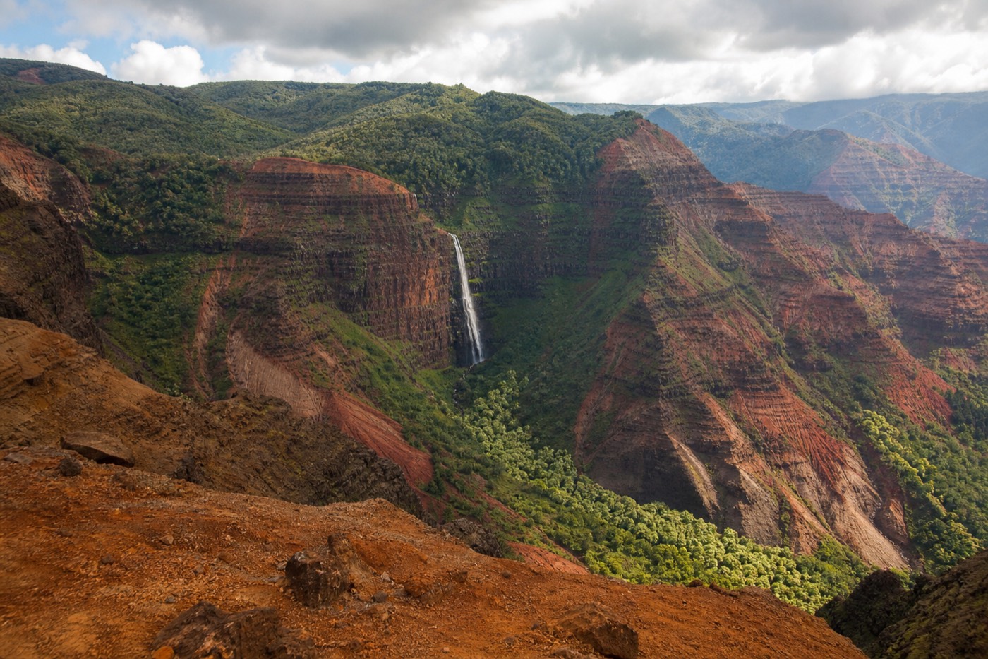
Most people who say they saw Waipoʻo Falls actually caught a thin silver streak from a canyon pullout, a thousand feet below their shoes and half a mile off. The trail changes that. It carries you to the top tier of the falls, where the water slides over red rock and pours toward the gorge, close enough to feel the mist on a strong flow day. It is the single best short hike in Waimea Canyon, and the one most visitors underestimate in both reward and effort.
Booking choice: Hear Hawaiian history and geology as offline GPS narration follows your own canyon drive. Explore Waimea Canyon Offline Audio Drive
What Is The Waipoʻo Falls Trail?
Waipoʻo Falls is the best-known waterfall inside Waimea Canyon, a multi-tier cascade that streaks down the red canyon wall. The trail to reach it links the short Cliff Trail with the longer Canyon Trail, starting off Halemanu Road near mile marker 14 on Route 550. Plan for roughly 3 to 3.6 miles round trip.
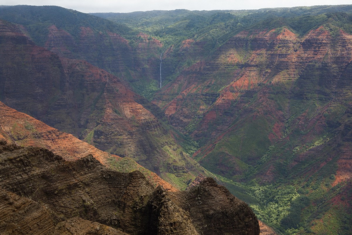
The falls sit inside the canyon itself, not up on the paved lookout road, which is why a proper look means walking. Water pours over an upper ledge into a shallow pool, then spills again lower down the cliff face, so what you see from the trail is the top of the system rather than one clean plunge. On heavy-rain days it fans out and roars. In a dry spell it narrows to a ribbon.
What surprises first-timers is how the trail earns its reputation without ever feeling remote. You are inside one of the most photographed canyons in the Pacific, yet within a few minutes of leaving the road the crowds thin to almost nothing. The lookout pullouts up the highway stay busy all day. The trail, even in peak season, hands you long stretches of solitude, red walls on one side and a green drop on the other, with the sound of the stream growing as you get closer. That contrast is a big part of why regular Kauai visitors rate this walk so highly.
Access is off Halemanu Road, a rough dirt spur that leaves Route 550 near the 14 mile mark. Passenger cars can usually reach the small pullout in dry weather, but the spur turns to slick red clay after rain and low-clearance rentals get stuck. Many hikers park up on the paved highway and walk the extra stretch in rather than risk the mud. From the trailhead you follow the Cliff Trail to a quick overlook, then branch onto the Canyon Trail, which contours along the canyon rim before dropping to the pool at the top of the falls.
The canyon around you is about 14 miles long and several thousand feet deep, the gash Mark Twain is said to have called the Grand Canyon of the Pacific. Those red-and-rust walls are old lava layers stained by iron, and that same iron-rich soil is what you will be walking on. It is beautiful, and when wet it is slick as soap, which is a theme you will meet more than once on this hike.
| Trail stat | What to expect |
|---|---|
| Round trip distance | About 3 to 3.6 miles (varies with where you park) |
| Elevation change | Several hundred feet down to the falls, then back up |
| Time on foot | 2 to 3.5 hours at a relaxed pace with stops |
| Difficulty | Moderate: short but with a real climb on the return |
| Surface | Dirt and red clay, roots, some rock; slick when wet |
| Trailhead | Halemanu Road spur off Route 550, near mile marker 14 |
| Shade | Mixed forest and open rim; bring sun cover for the open parts |
Distances get quoted a few different ways online because people measure from different starting points. Treat the numbers above as a planning allowance, not a survey. If you park on the paved road instead of driving the muddy spur, add roughly half a mile each way.
How Hard And How Long Is It?
Rate it moderate. The walk out to the falls is gentle and mostly downhill, which fools people into thinking the whole thing is easy. The climb back up in the afternoon heat is where it earns the rating. Budget two to three and a half hours, more if the ground is wet and you are picking your footing.
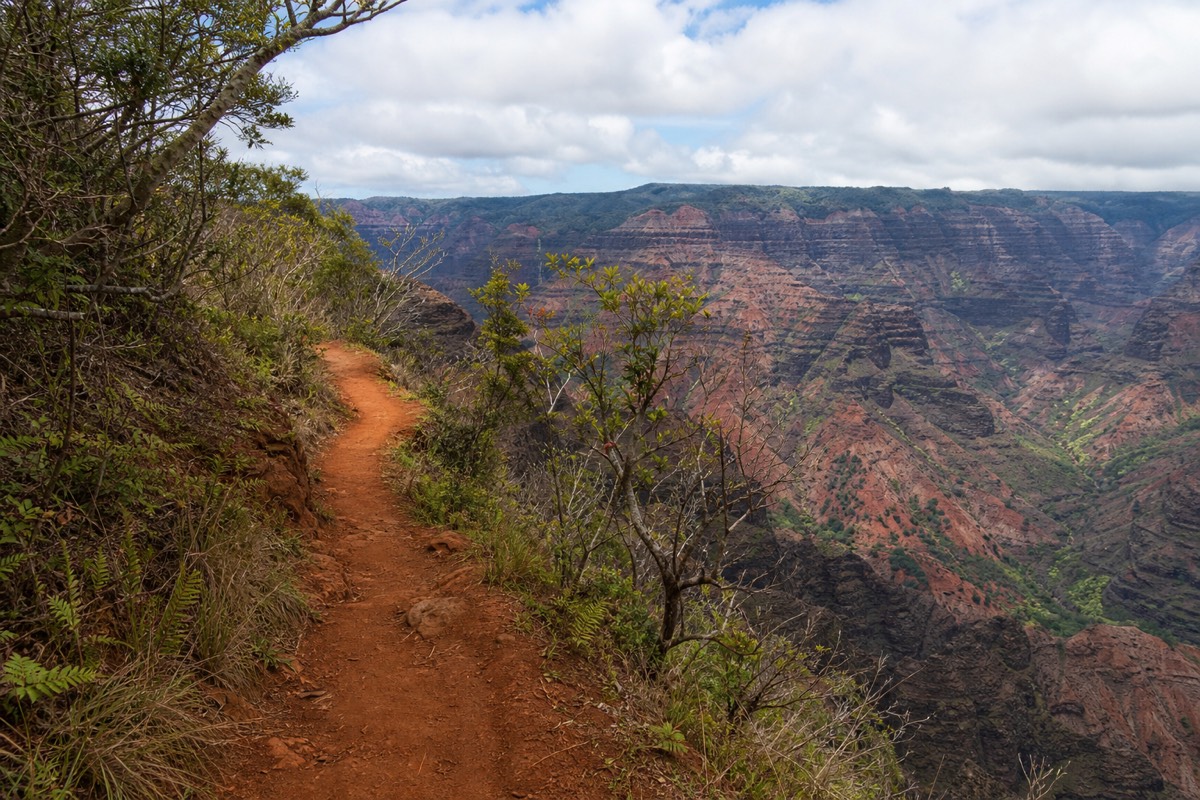
The catch of this hike is the shape of the effort. You spend the first half losing elevation on the way in, feeling strong, and then you pay all of it back on the return when the sun is higher and your legs are tired. It is not a long trail by mountain standards, but the red clay grabs at your shoes and the last climb toward the road is the part people remember.
Heat matters more than distance here. The lower you drop into the canyon, the warmer and stiller the air gets, and there is little water and patchy shade. Carry more water than a three mile hike would normally suggest, at least a liter per person and two on a hot day. Real hiking shoes with tread beat sandals or smooth-soled sneakers by a wide margin once you hit the clay.
Compare it honestly to other Kauai hikes and it lands in the friendly middle. It asks far more than a paved lookout stroll, and far less than the long ridge trails higher up in Kōkeʻe that drop over a thousand feet to a Nā Pali overlook. That is exactly why it is the trail this guide points most first-time visitors toward. You get a genuine canyon hike and a real waterfall payoff without committing a whole day or needing hiking legs. Slow walkers just add time and stops, and the trail forgives that.
Here is a realistic morning. You leave the car around eight, when the air is still cool and the canyon is clear. The Cliff overlook comes fast, a good spot for a first look and a few photos. The Canyon Trail unspools gently downhill for the next stretch, easy enough that you barely notice the elevation slipping away. You reach the top of the falls, rest on the rock, eat something. Then you turn around, and the same trail that felt effortless now climbs, the sun is higher, and that final push to the road is where you are glad you brought extra water. Back at the car by eleven, ahead of the clouds. That is the hike done well.
| Segment | Rough distance | Feel |
|---|---|---|
| Halemanu Road spur (if walked) | About 0.5 mi each way | Easy dirt road, adds time only |
| Cliff Trail to overlook | About 0.2 mi | Easy, quick canyon view, good turnaround for non-hikers |
| Canyon Trail to top of falls | About 1.2 to 1.5 mi | Gentle out, steady climb back |
| Falls pool area | Flat rock shelf | Shallow water; stay back from the edge |
The Cliff Trail And Canyon Trail Route
From the Halemanu trailhead you first reach the Cliff Trail, a two-tenths-of-a-mile spur to a railed overlook. To continue to the waterfall you take the Canyon Trail, which runs along the canyon rim through open scrub and forest before descending to the stream at the top of Waipoʻo Falls.
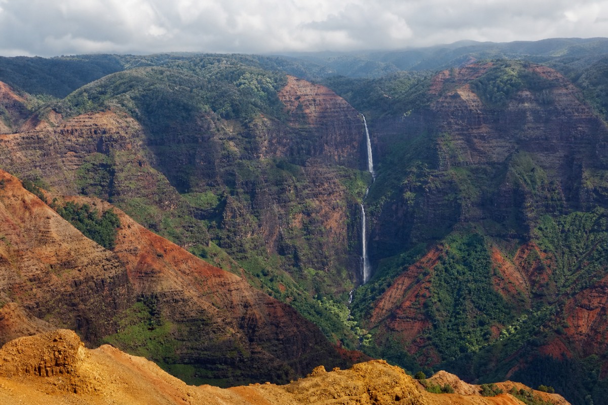
The Cliff Trail overlook is a legitimate destination on its own. It is flat, short, and delivers a sweeping look into the canyon with almost no effort, which makes it the natural turnaround for anyone who does not want the full hike. Kids and slower walkers can reach it and feel like they earned a real view.
Past that point the Canyon Trail does the work. It winds along the rim, opens onto red-dirt sections with big drops to one side, and then bends downhill toward the streambed. You will hear the water before you see it. The trail ends at a broad shelf of rock and a shallow pool at the lip of the upper falls, where the stream gathers and then goes over the edge. This is the classic Waipoʻo photo spot, and it is also where people take foolish risks. The rock near the lip is slick, the drop below is severe, and there is no railing. Enjoy the pool, keep well back from the edge, and never wade toward the brink.
Navigation is generally straightforward, but the network of trails up here does branch, and unofficial side paths lead off in confusing directions. Stay on the obvious main route, keep the canyon on the correct side of you, and if a fork looks sketchy or drops steeply toward the edge, it is not your trail. If you would rather not think about any of this, a guided small-group tour builds an easy, well-signed nature walk into the canyon day and leaves the route-finding to someone who does it weekly.
If you want a wider hiking context, our guide to the best hikes in Waimea Canyon and Kōkeʻe lays the Cliff and Canyon Trails alongside the longer rim trails so you can decide how ambitious to be.
When Does The Waterfall Run Strongest?
Waipoʻo Falls runs hardest after rain, which on Kauai's west side means the wetter winter months of roughly November through March. Dry summer weeks thin the flow to a ribbon but firm up the footing. The falls almost never vanish, but the difference between a fat cascade and a trickle is real.
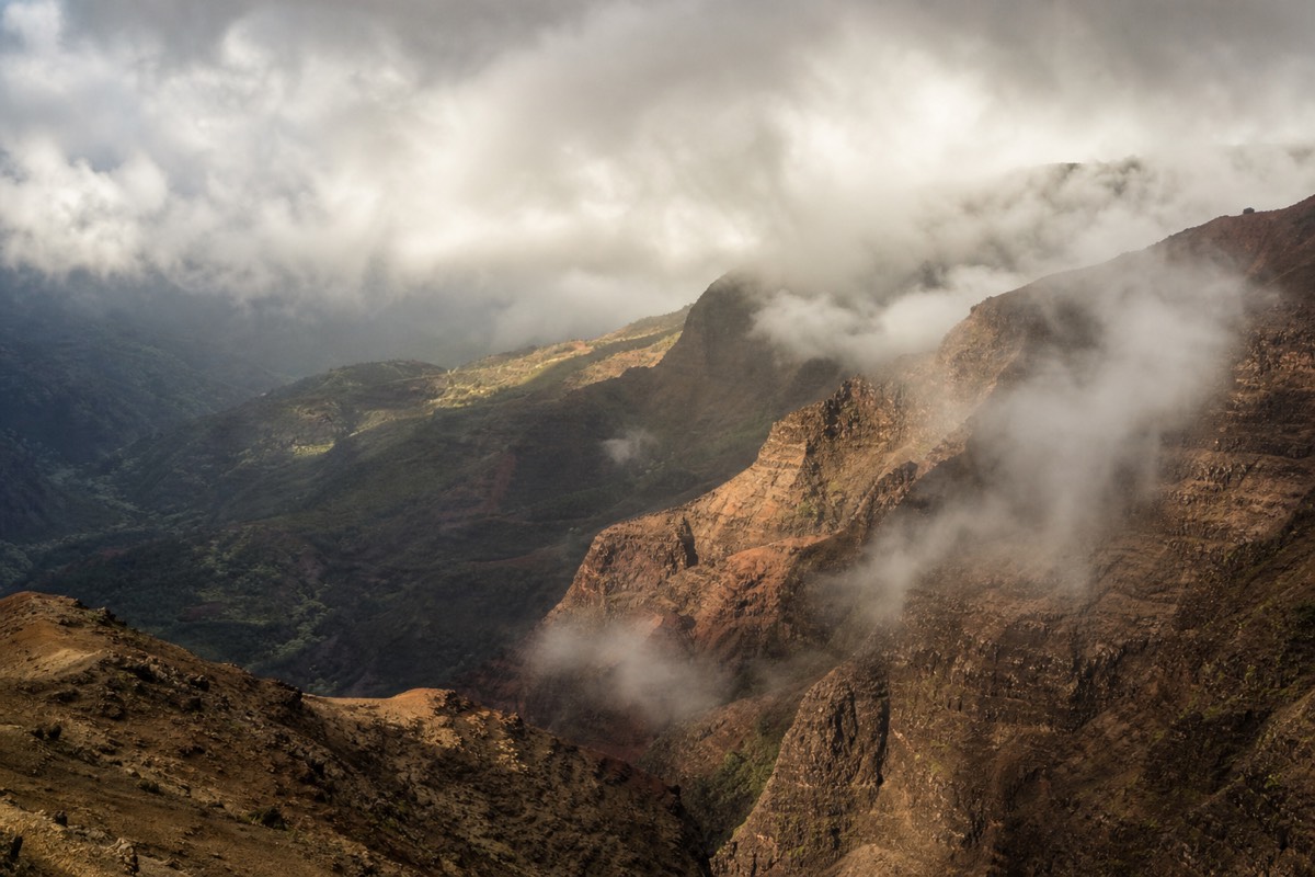
This is the trade-off nobody warns you about. The same rain that makes the falls thunder also turns the Halemanu spur and the clay trail into a mess, and it stacks clouds over the canyon that can hide the view entirely. A dry, clear morning gives you safe footing and long sightlines, but a leaner flow. There is no perfect answer, only the version you prefer.
| Season | Waterfall flow | Trail footing | Trade-off |
|---|---|---|---|
| Winter (Nov to Mar) | Strongest, often two full tiers | Muddiest, slick clay | Best water, worst mud, more clouds |
| Shoulder (Apr, May, Oct) | Variable, swings with recent rain | Usually workable | The gamble months, check the forecast |
| Summer (Jun to Sep) | Thinner, ribbon-like in dry spells | Firmest and safest | Best footing and clarity, least water |
Whatever the month, the timing rule that beats all others is to start early. Clouds and mist build over the canyon through the day, so a morning hike gives you both clearer air and cooler climbing. For the full reasoning on morning light and cloud build-up, see what time of day is best for the canyon.
How Do You Get To The Trailhead And Park?
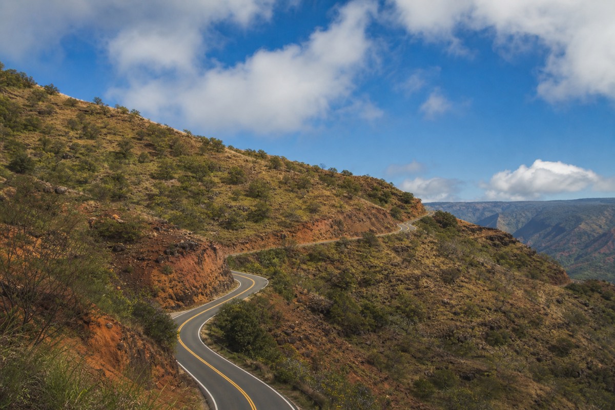
The trail leaves from the Halemanu Road spur off Route 550 near mile marker 14. In dry weather a normal car can nose in to the small pullout, but after rain the red-clay spur is a low-clearance trap. The safe play in any doubt is to park on the paved highway shoulder and walk the short extra stretch to the trailhead.
Halemanu Road is unpaved, narrow, and rutted, and it does not forgive optimism. Rental-car agreements often warn against exactly this kind of road, and a stuck car deep on the spur is a miserable way to spend the afternoon you meant for the falls. When the ground is even slightly wet, treat the spur as a walking path and leave the car up top.
Facilities are thin, so plan accordingly. There is no water, no store, and no reliable restroom at the trailhead itself, though the main canyon lookouts and Kōkeʻe up the road have restrooms. Fill your bottles before you leave the coast, and use the lookouts on the drive up. Cell signal is spotty to none, so download any map you want in advance.
| Access choice | When it works | Watch out for |
|---|---|---|
| Drive the Halemanu spur | Dry, firm conditions, some clearance | Red-clay ruts turn slick fast; stuck cars after rain |
| Park on Route 550 and walk in | Almost always; adds about half a mile each way | Park fully off the pavement, watch traffic |
| Guided tour drop | No car, no driving, mixed-ability group | Follows the guide's schedule, not yours |
Hiking Waipoʻo Falls With Kids
Confident walkers around eight and up handle the Waipoʻo Falls trail fine on a dry day, with an adult managing the exposed edges and the slick spots. Younger or reluctant kids do better with the short Cliff Trail overlook as the goal, which gives a big canyon view without the long climb back.
The honest concern with children here is not the distance, it is the drop-offs and the unguarded pool at the top of the falls. Sections of the Canyon Trail run close to steep edges with no railing, and the rock near the lip is exactly the kind of place a curious kid should never be near without a firm hand. If you know your child will treat every ledge as a challenge, this is not the hike for the day.
For families set on a full canyon outing, the Cliff Trail turnaround is the smart play: an easy walk, a fenced overlook, a genuine sense of the scale, and a car that is never far. Bring more water and snacks than you think a short walk needs, because the return climb tires small legs quickly. Our Waimea Canyon with kids guide covers which stops keep children engaged and which ones test everyone's patience.
For Seniors And Casual Walkers
Fit, steady seniors do the full hike regularly, but the climb back out in the heat is the deciding factor, not the walk in. If stairs or long uphill stretches are a problem, aim for the Cliff Trail overlook, which is short, close to the car, and rewards you with the canyon view most people came for.
The trail has no built stairs and no handrails on the main stretch, so it favors people who are comfortable on uneven, occasionally slick ground. The descent to the falls is manageable. The problem is that every foot you go down, you climb back up, and the afternoon sun turns that return into the hard part of the day. Trekking poles help a lot on the clay.
If a long climb is off the table, you still have good options. The Cliff Trail gives a real canyon panorama for a fraction of the effort, and the paved lookouts up Route 550 need no hiking at all. A guided small-group tour removes the driving and the mud decision entirely, timing a gentle canyon walk for the cooler morning and handling the winding road for you. Our Waimea Canyon for seniors and non-hikers guide maps out the low-effort, high-view version of the whole park.
| Hiker type | Full trail to the falls? | Better bet |
|---|---|---|
| Regular hikers | Yes, straightforward on a dry day | Do the full route, start early |
| Families with young kids | Case by case, mind the edges | Cliff Trail overlook and turn back |
| Steady, fit seniors | Often yes, poles help | Full route at a slow pace, or Cliff Trail |
| Limited mobility or knee issues | Not recommended | Paved lookouts and a guided nature walk |
Can You See Waipoʻo Falls Without Hiking The Trail?
Partly. On a good-flow day you can pick out Waipoʻo Falls as a distant thread from a couple of the paved canyon lookouts up Route 550, but you will not get the close, top-of-the-falls view without the trail. The genuinely no-hike way to see it well is from the air on a helicopter or fixed-wing flight.
From the main Waimea Canyon lookouts, sharp-eyed visitors spot the falls across the gorge, especially after rain when the water runs white against the red wall. It is a real sighting, but a small and distant one, more of a can-you-find-it moment than a face-to-face encounter. Bring binoculars and know roughly where to look.
The air option is the honest answer for anyone who wants a dramatic view of the falls with zero walking. Flights trace the canyon and swing past the waterfalls that feed it, and the perspective from above is something no trail can match. We break down the details in can you see Waipoʻo Falls without hiking, including which lookouts give the best distant glimpse and when the air view pays off.
| How you see it | View quality | Effort | Best for |
|---|---|---|---|
| Canyon Trail hike | Close, top-of-the-falls | Moderate hike | Hikers who want the full payoff |
| Paved lookout glimpse | Distant thread across the gorge | None | Quick stops, binocular spotters |
| Helicopter or air tour | Dramatic, from above | None | No-hike travelers, photographers |
| Guided van tour plus short walk | Lookouts plus an easy nature walk | Low | Non-drivers, mixed-ability groups |
Safety, Footing And Mud After Rain
The two real hazards on the Waipoʻo Falls trail are slick red clay and unguarded drop-offs, both worst right after rain. Never approach the lip of the falls, watch for flash-flood conditions in the streambed during heavy rain, and turn back if the trail becomes a slide. The view is not worth a fall in the canyon.
Waimea Canyon's soil is fine red clay that behaves like grease when it is wet. A dry-day trail can become genuinely dangerous within an hour of a downpour, particularly on the sloped sections near the edges. Good tread, poles, and a willingness to abandon the plan are your best tools. Flip-flops and smooth soles are how people end up on the ground.
Flash flooding is the other serious risk. Streams that feed Waipoʻo Falls can rise fast when heavy rain falls upslope, even if it is not raining where you stand. Do not cross or linger in the streambed during or right after a storm, and never try to get below the falls. The upper pool is for looking, not swimming toward the edge.
Pack for a hike longer than the mileage suggests, because the heat and the clay both punch above the distance. The short list below is what this guide hands people before they head up. None of it is exotic, and all of it earns its place on this particular trail.
| Bring this | Why it matters on this trail |
|---|---|
| Grippy hiking shoes | Red clay is slick when wet; smooth soles slide |
| Water, more than you think | Hot canyon air, no water on the trail |
| Trekking poles | Steady you on the muddy climb back out |
| Sun protection and a hat | Open rim sections have no shade |
| Light layer or rain shell | Weather up here flips quickly |
| Snacks and a plan told to someone | Fuel for the return; safety if signal drops |
A few practical habits keep this hike in the fun column: start early, carry more water than feels necessary, tell someone your plan, keep back from every unrailed edge, and let the weather make your decision instead of your schedule. A guided Waimea Canyon Tour takes the mud-and-timing guesswork off your plate and puts a local in charge of when to go, which is worth a lot on a day the forecast is uncertain.