West Kauai Guide: Hanapepe, Waimea Town and Kauai Coffee
The west side is Kauai at its quietest and most old-Hawaii: a swinging footbridge, a two-century-old coffee farm, a blowhole that snorts seawater, and the road to the island's grandest view.
Drive west from Līhuʻe and the island changes character. The resorts thin out, the land dries and reddens, and the towns get smaller and older. This is the west side, the launch pad for Waimea Canyon and, on its own, one of the most rewarding half-days on Kauai. Most visitors blow through it on the way uphill. The ones who slow down find the parts of Kauai that feel least like a postcard and most like a place people actually live.
Booking choice: Explore canyon lookouts, Kalalau and the south shore with your own driver-guide. Explore Private Canyon & South Side Day
What Is West Kauai And Why Visit It?
West Kauai runs from the south-shore beaches of Poʻipū out through Hanapepe and Waimea to the canyon road and Polihale. It is the island's driest, sunniest, and least crowded region, packed with real history: the first landing spot of Captain Cook, a two-century coffee estate, and small towns that never got the resort treatment.
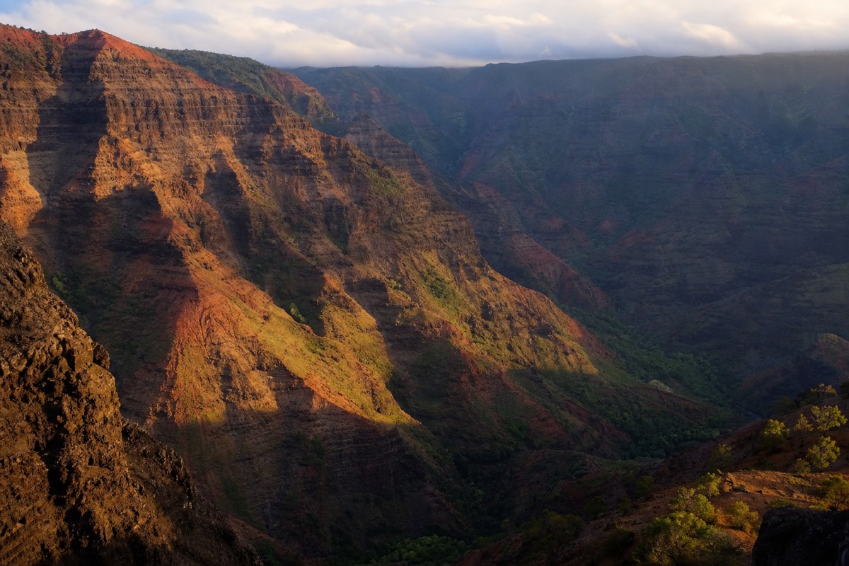
The appeal is contrast. The north shore is lush and famous. The west side is red-dirt, sun-baked, and comparatively empty, and it wears its past openly. You can walk a footbridge that a plantation town built by hand, stand where the first European ship reached the islands, and drive past miles of coffee before climbing into a canyon a mile wide. It also happens to be the gateway to the highlands, so most canyon trips pass straight through it.
Because so much of the west side clusters along one highway, it strings together neatly in a day. Our Waimea Canyon travel guide covers the rim itself in depth. This page is about everything at sea level on the way there and back.
| Stop | Where | How long to allow | Best for |
|---|---|---|---|
| Spouting Horn | Poʻipū / Kōloa | 20–30 min | Quick photo, blowhole spray |
| Poʻipū beaches | South shore | 1–2 hrs | Turtles, monk seals, swimming |
| Kauai Coffee Company | Kalāheo / ʻEleʻele | 45–60 min | Free samples, self-guided walk |
| Hanapepe town | Hanapepe | 1 hr | Swinging bridge, art galleries |
| Waimea town | Waimea | 45 min | History, lunch, canyon-road base |
| Russian Fort (Pāʻulaʻula) | Waimea River mouth | 30 min | Ruins, history, river view |
How Do You Get To West Kauai, And When Should You Go?
West Kauai is a straight drive west from Līhuʻe on Kaumualiʻi Highway, roughly 30 to 45 minutes to the main towns and about an hour to the base of the canyon road. Mornings suit the canyon, when skies are clearest. Afternoons suit the coast. As the driest, sunniest side of the island, it delivers year-round.
There is essentially one road, which makes the west side easy to navigate. Kaumualiʻi Highway hugs the south and west coasts, threading Kōloa, Kalāheo, Hanapepe, and Waimea before the canyon road branches uphill. Fill the tank in Waimea, since fuel and services thin out past it, and remember that the last reliable stops for food and water sit at the base of the climb.
Timing rewards a little planning. The canyon lookouts are clearest in the morning before clouds build, so sightseers who care about the view go up early and save the beaches, coffee, and towns for the warm afternoon. Rain falls more often on the north and east of the island, which is exactly why the west side stays sunny, making it a dependable choice even when the rest of Kauai is gray. Our guide to the best time to visit digs into the seasons and the daily cloud pattern.
What Is The Hanapepe Swinging Bridge, And Is It Worth Crossing?
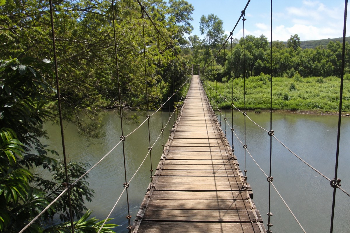
The Hanapepe swinging bridge is a hand-built pedestrian footbridge that sways over the Hanapepe River in the heart of the old town. It is short, free, and a little wobbly, and it is the town's signature photo. Cross it, then wander the wooden storefronts of what locals proudly call Kauai's biggest little town.
Hanapepe was once a bustling plantation hub, and it kept its early-1900s bones when the sugar money moved on. The swinging bridge is the star: a suspension footbridge rebuilt by the community after storms, bouncing gently as you walk it above the river. It takes two minutes to cross and rewards you with a look back at the tin-roofed town.
The rest of Hanapepe is a slow browse of art galleries, a bookshop, and small kitchens. On Friday nights the town throws an art walk that fills the street. Guided west-side tours, including cruise-port runs, often build in a stop here precisely because the bridge and the old storefronts pack a lot of character into a short visit.
Hanapepe nods to the movies, too. Its sleepy main street and river stood in for scenery in animated and live-action films, and locals will happily point out the connections. Nearby, look for the traditional salt ponds, where families still harvest sea salt in shallow red-earth beds using methods handed down for generations. That is a working cultural practice, not a display, so admire it from a respectful distance.
| Hanapepe highlight | What it is | Notes |
|---|---|---|
| Swinging bridge | Pedestrian suspension footbridge | Free, short, sways as you cross |
| Art galleries | Working artist studios and shops | Best browsed on foot |
| Friday art walk | Evening street event | Food, music, open galleries |
| Salt Pond | Traditional Hawaiian salt beds nearby | Respect active harvest areas |
What Is There To See In Waimea Town?
Waimea town sits at the mouth of the Waimea River, right where the canyon road begins. It is where Captain Cook first landed in the Hawaiian Islands in 1778, the seat of the last independent chief of Kauai, and the natural lunch-and-fuel stop before the climb. Small, historic, and unhurried, it is the west side's anchor.
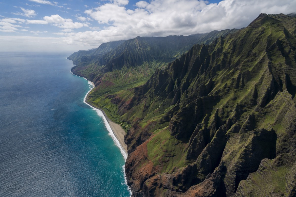
History runs deep here. A statue of Captain Cook marks the 1778 landing, and the town was the base of King Kaumualiʻi, the chief who kept Kauai independent longest. You will find a walkable main street, a few good local kitchens, and the last reliable stop for water and snacks before the canyon road, which is worth remembering because there is little at the top.
Treat Waimea as the pivot of the day. Coming from the coast, it is where the flat drive ends and the switchbacks begin. Coming down from the rim, it is where you exhale and refuel. A private tour of the canyon and south side often threads Waimea into the route for exactly this reason.
Waimea holds a quieter claim to fame as well. The town sits near the launch area for many west-side operators heading to the Nā Pali Coast, and its river valley is one of the greener breaks in the dry coastline. Give a few minutes to the Captain Cook monument and the old churches, and you get a compact sense of how layered this small town's story really is, with Hawaiian, missionary, and plantation history all inside a few blocks.
What Is Spouting Horn And How Does It Work?
Spouting Horn is a natural blowhole on Poʻipū's shore where waves force seawater through a lava tube and shoot a plume into the air, sometimes 30 feet or more. A second vent groans as air escapes, which old Hawaiian legend tied to a giant moʻo, a lizard, trapped beneath the rock. It is a five-minute stop with a big payoff.
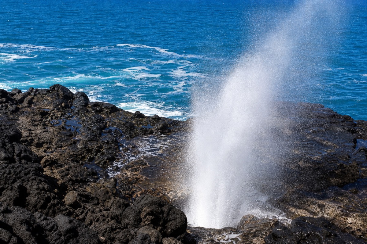
The mechanics are simple and hypnotic. Surf surges into a lava tube, compresses, and blasts up through a hole in the rock shelf, throwing spray and a hiss with each set. Bigger swells make bigger spouts, so timing and the sea state decide the show. There is a viewing area, railings, and usually a cluster of vendors selling shell jewelry.
Do not climb onto the wet rocks to chase a better angle. The shelf is slick and the surf is unpredictable. Watch from the marked area and let a big set come to you. Spouting Horn pairs naturally with a Poʻipū beach stop, since they sit minutes apart.
| Spouting Horn fact | Detail |
|---|---|
| What it is | Natural lava-tube blowhole |
| Height of spray | Varies with swell, up to ~30 ft or more |
| Second vent | Makes a groaning, snorting sound |
| Legend | A giant moʻo (lizard) said to be trapped below |
| Time needed | 15–30 minutes, including vendors |
Can You Tour The Kauai Coffee Company?
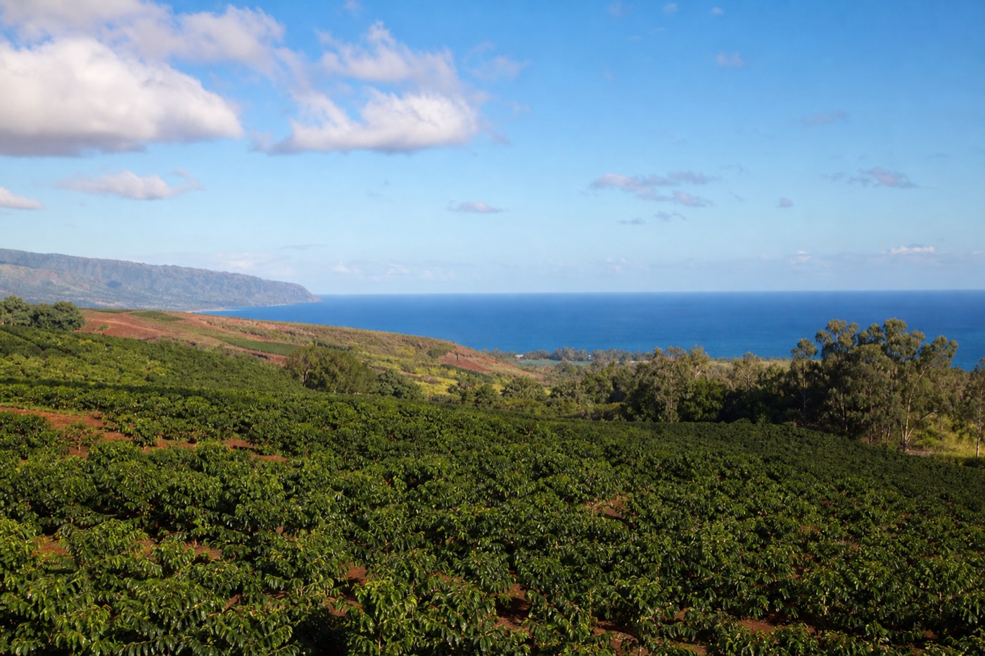
Yes. The Kauai Coffee Company is the largest coffee farm in the United States, spread across thousands of acres near Kalāheo. Its visitor center offers free tastings, a self-guided walking loop through the orchards, and a shop. Entry to walk and sample is free, which makes it one of the west side's best-value stops.
Coffee replaced sugar on this land, and the scale is genuinely impressive: rows of trees running toward the sea, millions of plants, and a tasting bar where you can work through half a dozen roasts for nothing. A short self-guided path explains how the cherries are grown, picked, and processed, and guided farm tours run for those who want to go deeper.
Practically, it is an easy, shaded break that both adults and kids enjoy, and it sits right on the highway toward the canyon. Many west-side and cruise-port itineraries include a coffee stop, sometimes with samples poured on the bus, because it slots neatly into the drive without eating much time.
If you drink coffee, taste widely before you buy. The estate grows several varietals and roasts them across the range from light to dark, and the differences at the tasting bar are genuine. Staff can steer you toward a bag that suits how you brew at home. Even non-drinkers tend to enjoy the walk, since the orchard rows running down toward the sea make an unexpectedly pretty stroll.
| Kauai Coffee visit | Detail |
|---|---|
| Claim to fame | Largest coffee farm in the US |
| Tastings | Free at the visitor center |
| Self-guided walk | Free loop through the orchard |
| Guided farm tour | Available for a fee |
| Time needed | 45–60 minutes |
What About Poʻipū Beaches, Sea Turtles, And Monk Seals?
Poʻipū is the sunny south-shore beach town where families swim, snorkel, and spot wildlife. Green sea turtles feed along the reef, and endangered Hawaiian monk seals regularly haul out to rest on the sand. Give both a wide berth. Monk seals are protected by law and must not be approached.
Poʻipū Beach Park is the anchor, with a protected keiki pool for small children and a snorkeling reef just offshore. Turtles graze on the algae along the rocks and are easy to spot without chasing them. Monk seals are the real privilege: only around 1,500 remain, and when one flops onto the sand to sleep, volunteers often rope off a respectful perimeter. Stay well back, keep dogs and drones away, and let it rest.
A private tour that pairs the canyon with the south side often finishes here, trading the cool rim for warm sand and wildlife. It is a satisfying arc: dramatic highlands in the morning, gentle coast in the afternoon.
Snorkeling here is beginner-friendly on calm days, with reef fish, the occasional turtle gliding past, and clear water inside the protected areas. Conditions shift with the surf, so check the flags and ask a lifeguard before wading in with children. Poʻipū also has easy shade, restrooms, and food nearby, which makes it the most family-practical beach on this side of the island.
| Poʻipū spot | Good for | Note |
|---|---|---|
| Poʻipū Beach Park | Families, snorkeling | Protected keiki pool |
| Reef edges | Green sea turtles | Watch, never touch or feed |
| Open sand | Hawaiian monk seals | Endangered, stay far back |
| Shipwreck Beach | Bigger surf, cliff walk | Strong swimmers only |
What Is The Russian Fort (Pāʻulaʻula)?
Pāʻulaʻula, better known as the Russian Fort, is a ruined star-shaped fort near the mouth of the Waimea River. Built in the early 1800s during a brief and tangled alliance involving a Russian trading agent and King Kaumualiʻi, its low stone walls are one of Kauai's stranger history stops, a quick and free detour.
The story behind it is odd enough to be memorable. In the 1810s a German agent working for a Russian trading company got tangled up in Kauai's politics and started building forts, this one included, before the whole scheme collapsed. What remains are grassy earthworks and stone walls above the river, with interpretive signs and a view back toward Waimea town.
It will not fill an hour, but it adds real texture to the west side's history, and it sits right where the canyon road meets the coast. A good guide turns the ruins into a genuinely surprising story rather than a pile of rocks.
What Is Polihale And The Far West End?
Polihale State Park is the wild western terminus of the road, home to Kauai's longest beach and the southern start of the Nā Pali cliffs. Reaching it means a few miles of rough dirt road, so it suits sturdy vehicles and unhurried travelers. The reward is vast empty sand and some of the island's best sunsets.
Where the paved highway gives out past Kekaha, a dirt cane road runs the last stretch to Polihale. It is bumpy, sometimes muddy, and generally off-limits under rental-car agreements, so many visitors skip it or leave it to a capable local driver. Those who make it find miles of open beach backed by dunes, with the Nā Pali cliffs rising to the north and Niʻihau floating offshore.
Swimming is dangerous here, with strong currents and no lifeguards, so Polihale is a place to walk, watch, and photograph rather than dive in. Bring water, sun cover, and everything you need, because there are no services at all. As a sunset finale to a west-side day it is hard to beat, but treat it as a serious drive, not a casual detour.
How Do You Combine West Kauai With A Canyon Day?
The efficient plan climbs to the canyon first, while the morning light is clear and the rim is uncrowded, then works back down through the west-side towns as the day warms. Start at the top, descend through Waimea and Hanapepe, sample coffee, and finish at Poʻipū. One highway ties it all together.
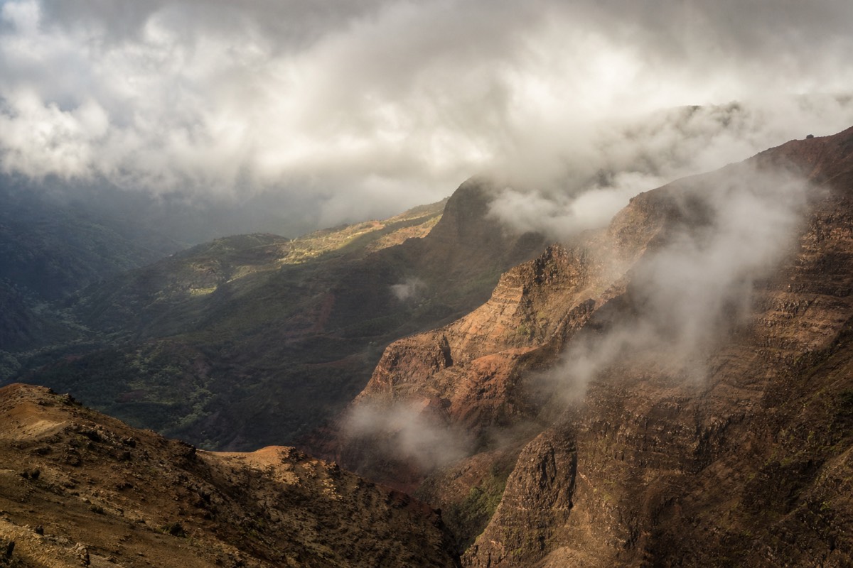
The single most important timing rule on the west side is to hit the canyon lookouts early, because clouds and mist build over the rim and the Nā Pali-facing overlooks by afternoon and can erase the view. So the smart day runs uphill first. Reach the lookouts by mid-morning, spend your clear-sky window at the rim, then unwind on the way down when the coast is at its best.
If you are arriving by ship, that ordering matters even more, and our Waimea Canyon shore excursions from Nawiliwili page walks through the port-day math. For the highest overlook of all, the Kalalau Lookout is the one to reach before the clouds win.
The reverse order works only if the weather cooperates, which it often does not. Save the canyon for late morning and you gamble against the clouds. Save it for the drive home and you may find the top socked in. When in doubt, trade a lazy start for a clear view, because the coast forgives loose timing in a way the rim simply does not.
| Time | Stop | Why now |
|---|---|---|
| Early morning | Drive straight to the canyon rim | Clear skies before clouds build |
| Late morning | Waimea Canyon and Kalalau lookouts | Best light and visibility |
| Midday | Descend to Waimea town for lunch | Refuel at the base of the road |
| Early afternoon | Kauai Coffee and Hanapepe | Shaded, easy, walkable |
| Late afternoon | Spouting Horn and Poʻipū | Warm coast, turtles, sunset |
Where Should You Eat On The West Side?
The west side runs on small local kitchens, not resort dining. Expect plate lunches, shave ice, fresh fish, and famous roadside stands rather than white tablecloths. Waimea and Hanapepe hold the most options, and it is smart to eat before or after the canyon rather than expecting much at the top.
Food here is unpretentious and good. Waimea town has a well-known burger-and-fish spot and a shrimp truck reputation, Hanapepe leans toward cafes and a locally loved bakery, and shave ice turns up where you least expect it. Portions are generous and prices are gentler than the resort corridors.
Plan around the canyon's thin options. There is a lodge near the top with limited hours, but counting on it is risky. Carry water and a snack, eat a real meal down in the towns, and treat any rim food as a bonus.
For something sweet, keep an eye out for shave ice and the island's taro and sweet-bread bakeries, which turn up in the small towns and make an easy treat for the drive. None of it is fancy, and that is exactly the west side's charm.
| Where | Style | Good to know |
|---|---|---|
| Waimea town | Plate lunch, fish, burgers | Best fuel stop for the canyon road |
| Hanapepe | Cafes, bakery, art-walk food | Friday nights get busy |
| ʻEleʻele | Casual local spots | Near the coffee farm turnoff |
| Near the rim | Limited lodge dining | Do not rely on it; pack snacks |
Is West Kauai Worth Visiting?
Yes, especially paired with the canyon. On its own the west side is a relaxed half-day of history, coffee, a blowhole, and quiet beaches. Combined with the rim, it becomes a full and varied day that shows a side of Kauai most visitors miss, all along a single, simple highway.
If your time on Kauai is short and you want one big landmark, the canyon is the answer. But if you can give the west side a full day, the towns, the coffee farm, and the south-shore wildlife round the experience into something richer than lookouts alone. A private full-day tour is built to link exactly these dots, which is why it stays popular despite the price.
However you go, the west side rewards an unhurried pace. It is Kauai with the volume turned down, and that is the point. Book a Waimea Canyon Tour that folds in these stops and you leave with the highlands and the old towns both, not one at the expense of the other.