Grand Canyon of the Pacific: How Waimea Canyon Formed
Mark Twain is said to have called it the Grand Canyon of the Pacific. Behind the nickname is a story of a collapsing volcano, one of the wettest spots on Earth, and a river with millions of years of patience.
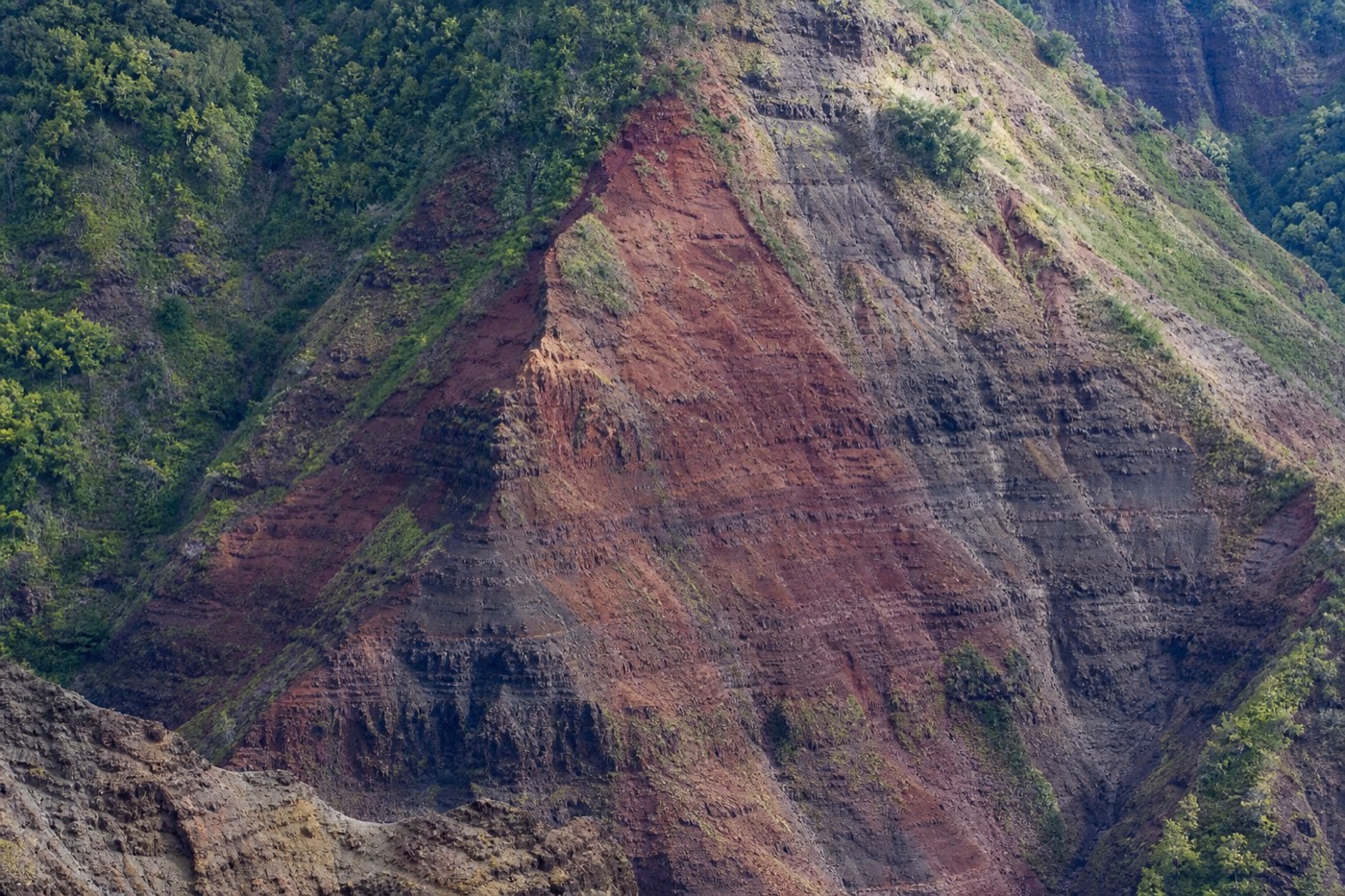
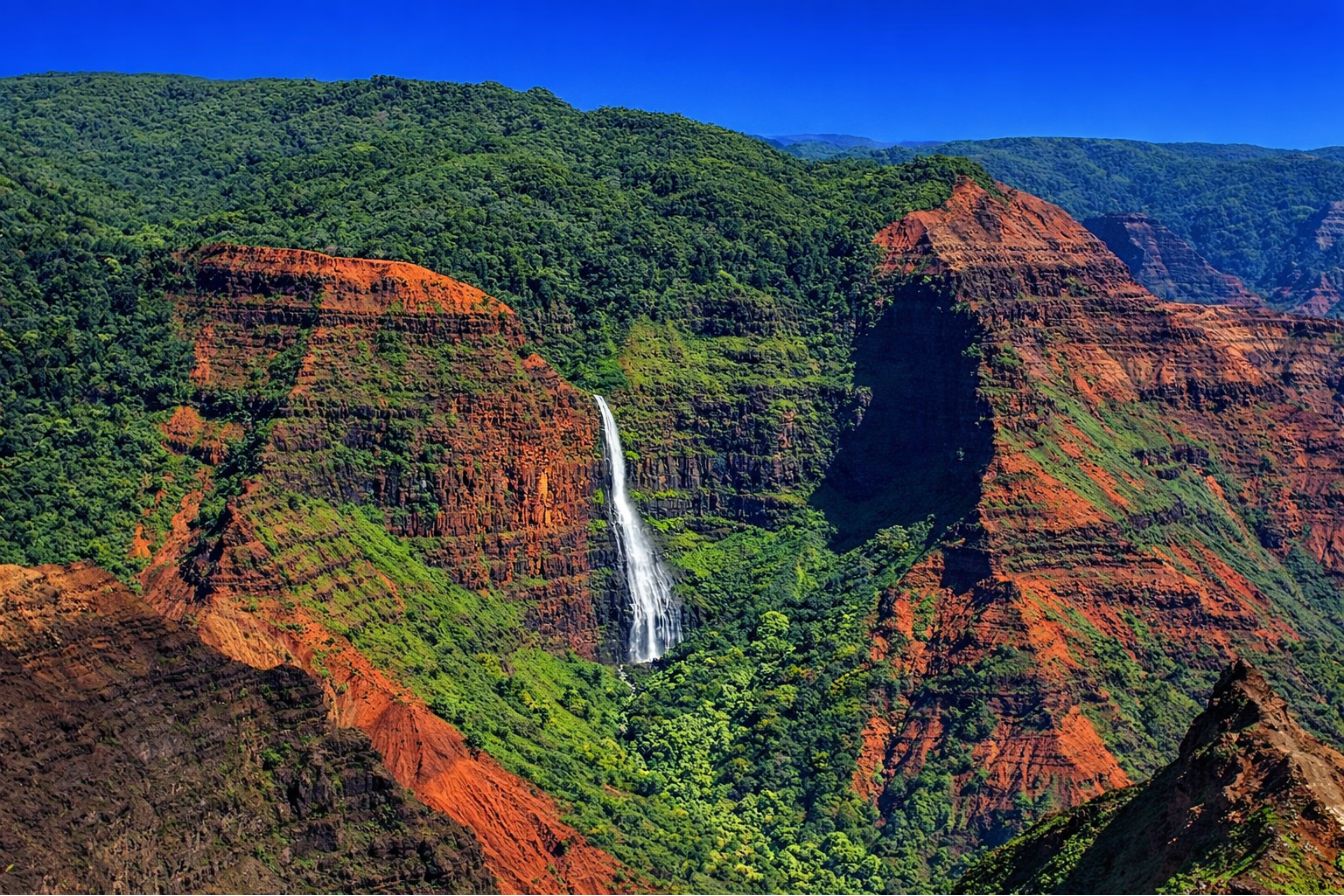
Stand at the Waimea Canyon Lookout and the scale plays a trick on you. The walls fall away in rust-red bands streaked with green, a silver thread of river far below, the whole gorge running mile after mile into the haze. It looks ancient and permanent. What you are actually seeing is a young island tearing itself down almost as fast as it built itself up, and the way it happened is stranger than the nickname suggests.
Booking choice: Hear Hawaiian history and geology as offline GPS narration follows your own canyon drive. Explore Waimea Canyon Offline Audio Drive
How Was Waimea Canyon Formed?
Waimea Canyon formed from two forces working together. First, the volcano that built Kauai partly collapsed and faulted, dropping a huge block of the island and creating a deep structural low. Then the Waimea River spent millions of years cutting down through the stacked lava flows, deepening and sharpening that low into the canyon you see today.
Most people assume a canyon this size was carved by water alone, the way the Grand Canyon in Arizona was. Kauai's story has an extra chapter. Geologists describe an early collapse of the Waiʻaleʻale shield volcano, a caldera-and-fault event that dropped part of the island and left a depression filled with different, softer lava. That head start gave the river a deep, weak seam to attack.
From there it became a patient carving job. The Waimea River, fed by the staggering rainfall of the summit, poured down that seam and cut through layer after layer of old lava flows. The result is a canyon that is part fault-block collapse and part river erosion, which is exactly why it is deeper and more dramatic than a young island's river alone should be able to manage.
How much came from collapse and how much from the river is still being refined by researchers, but the combination is the accepted picture. You can read the evidence in the walls. The lower canyon exposes one set of lava flows, while a distinct band of younger lava shows up where the old depression was later topped off, a seam the river found and followed. That is why the canyon cuts where it does rather than somewhere else on the island.
| Waimea Canyon by the numbers | Approximate figure |
|---|---|
| Length | ~14 miles |
| Depth | ~3,500 to 3,600 feet |
| Width | ~1 mile across at points |
| Age of the island (Kauai) | ~5 million years, the oldest main island |
| Nickname | Grand Canyon of the Pacific |
| Rim elevation at top lookouts | ~3,400 to 4,000 feet |
Treat the numbers as well-rounded approximations rather than surveyed precision. The point they make is consistent: this is a big canyon on a small, old island, and both facts are part of the same story.
Why Is Waimea Canyon Red And Green In Places?
The red comes from iron. Kauai's lava is rich in iron, and as it weathers it rusts, staining the rock in bands of rust, ochre, and deep crimson. The green comes from life: ferns, ʻōhiʻa, and other plants cling to the wetter ledges and terraces, especially where seeps and small waterfalls keep the rock damp.
Think of the color as chemistry and biology painted onto the same wall. The basalt that built the island is loaded with iron minerals. Expose it to Kauai's rain and humidity for long enough and it oxidizes, literally rusting, which is why the dry, freshly eroded faces glow orange and red in low sun. Different lava flows weather to different shades, giving the canyon its striped, layered look.
The green is opportunism. Wherever water lingers on a ledge or a seep keeps a slope damp, vegetation takes hold, softening the red with vivid patches of plant life. After a morning shower the contrast peaks, and thin waterfalls thread the walls while mist rises off the floor. That mix of rusted rock and stubborn greenery is the canyon's signature.
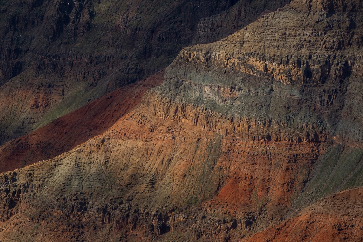
Weathering also explains the horizontal stripes. Each lava flow cooled with a slightly different mineral makeup, so each weathers to its own shade, stacking the wall into ribbons of rust, gray, and gold. Add the angle of the sun and the color shifts through the day, which is why photographers work the canyon at sunrise and again in the last hour of light.
| Color | Cause | Where it shows best |
|---|---|---|
| Red and ochre | Iron in the lava oxidizing (rusting) | Dry, exposed cliff faces in low sun |
| Green | Ferns and forest on damp ledges | Wetter slopes, seeps, waterfall lines |
| Gray and black | Fresher, less-weathered basalt | Recently exposed rock, shadowed walls |
| Purple and gold | Mixed weathering and light angle | Sunrise and late-afternoon light |
How Deep, How Long, And How Old Is The Canyon?
Waimea Canyon runs about 14 miles long, reaches roughly 3,500 to 3,600 feet deep, and spans close to a mile across at its widest. It sits on Kauai, the oldest of the main Hawaiian islands at around five million years, which is precisely why erosion has had time to cut so deep.
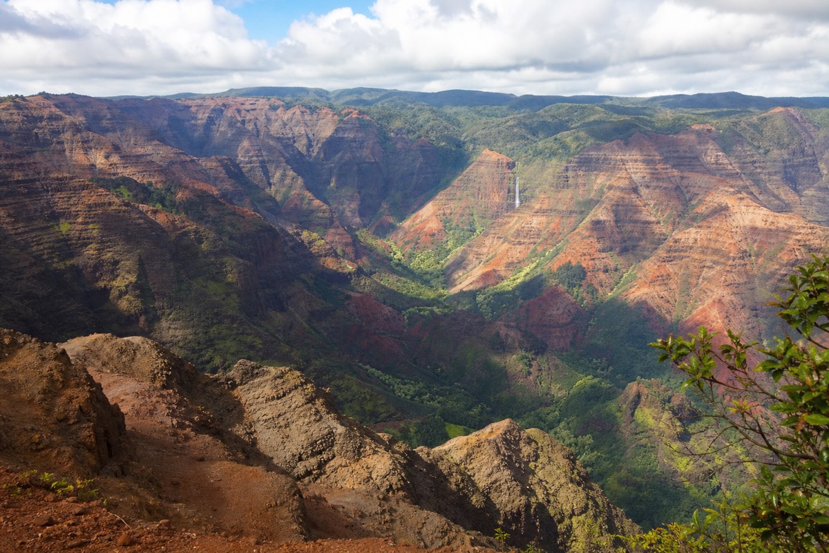
Depth is the figure that surprises people. From the top lookouts you are peering down the better part of two-thirds of a mile to the canyon floor. The length means the gorge keeps unfolding as you drive the rim road, showing new walls and side valleys at each pullout. Width gives it the airy, wide-open feel that a narrow slot canyon lacks.
Age ties it all together. Kauai rose from the sea first among the main islands and has had millions of years more weathering than young Hawaiʻi Island to the southeast. On an old, wet island, water wins. Give a river five million years and the rain of one of the planet's wettest summits, and it will cut a canyon like this.
For perspective, the depth is the height of several skyscrapers stacked, and the length would take most of a morning to drive along the rim road with stops. Yet all of it sits on an island you can circle in a day. That compression of scale, immense vertical relief on a small landmass, is part of why the first look over the edge lands so hard.
What Role Did The Waimea River Play?
The Waimea River is the canyon's sculptor. Fed by runoff from the Alakaʻi plateau and the drenched summit region near Mount Waiʻaleʻale, the river carried enormous volumes of water and sediment down the island's structural low, grinding through lava flow after lava flow to deepen the gorge over millions of years.
Rivers cut canyons with tools, and the Waimea River's tools were the rock and grit it dragged along its bed. Every flood pulse scoured a little deeper. The volume mattered as much as time, because the summit above is one of the wettest places on Earth, drenched by hundreds of inches of rain a year, and much of that water funnels toward the Waimea drainage.
You still see the river far below as a bright thread on the canyon floor, and its tributaries account for the side canyons and hanging valleys that make the walls so intricate. Where those side streams meet the main gorge, they leave the waterfalls the canyon is known for.
Sediment is the other half of the river's work. Water alone smooths rock slowly, but water loaded with grit and boulders acts like a rasp, and flash floods off the summit sent pulses of exactly that down the gorge. Over millions of years those abrasive floods did the heavy cutting, while everyday flow kept the channel clear. The bright thread you see from the rim is the quiet phase of a process that is violent when it counts.
What Is Kauai's Volcanic History?
Kauai is a single large shield volcano, Waiʻaleʻale, built by countless lava flows that stacked into a broad dome around five million years ago. After its main building phase, part of the volcano collapsed and faulted, and a later burst of eruptions filled parts of that depression. Erosion has been dismantling the island ever since.
Every Hawaiian island began as a shield volcano over the same deep hot spot, growing as the Pacific plate drifted northwest. Kauai formed early, then drifted off the hot spot and went quiet, which is why it has no active volcanism today and why its slopes are so deeply carved. The collapse of its summit region created the low that the Waimea River would later exploit.
Those stacked lava flows are what you read in the canyon walls. Each horizontal band is an old flow, and the sequence records eruption after eruption. A guided visit up to Kōkeʻe and the rim lets you see that layering up close, band by band, in the exposed cliffs.
Kauai's quiet today is the key to its drama. Once an island drifts off the hot spot, no new lava arrives to resurface it, so erosion works uninterrupted. Younger islands to the southeast are still being built and repaved by eruptions, which keeps their canyons shallow. Kauai has simply had a long, wet head start on being taken apart, and Waimea Canyon is the deepest single cut of that long unraveling.
| Stage | What happened |
|---|---|
| Shield building | Waiʻaleʻale volcano grows from stacked lava flows over the hot spot |
| Collapse and faulting | Part of the summit drops, creating a deep structural low |
| Late volcanism | Renewed eruptions partly fill the depression with new lava |
| Erosion (ongoing) | Rain and the Waimea River carve the canyon and the Nā Pali cliffs |
Why Does The Canyon Have So Many Waterfalls?
Extreme rainfall plus vertical rock equals waterfalls. The wet summit above the canyon sheds huge amounts of water, and where side streams meet the steep main gorge they spill over the edge. Waipoʻo Falls is the best-known, a long ribbon dropping into the canyon that is visible from the rim after rain.
The waterfalls are erosion made visible. As the main canyon cut down faster than its side streams could keep up, those tributaries were left hanging above the gorge, so their water now free-falls over the walls. After a morning shower dozens of thin, temporary falls streak the cliffs, then fade as the rock drains.
Waipoʻo Falls is the headliner, a two-tiered drop you can glimpse from certain lookouts and reach on a trail. Because the flow depends on recent rain, the falls are at their most dramatic soon after a shower, which is one more reason to be at the rim early. Our Waipoʻo Falls trail guide covers how to see it up close, and if hiking is not your thing, there are rim angles that catch it too.
How Is The Nā Pali Coast Part Of The Same Story?
The Nā Pali Coast and Waimea Canyon were shaped by the same forces on opposite sides of the island. The rain and rivers that cut the canyon also carved the deep, fluted valleys of Nā Pali, where whole flanks of the coastline collapsed into the sea. Canyon and coast are two faces of one eroding volcano.
Reach the top lookouts and you can almost see both at once. Kalalau Lookout peers down a valley that opens straight toward the Nā Pali cliffs, because the drainage that helped shape the canyon system also runs toward that coast. Those fluted green ridges are erosion in vertical form, the same stacked lava flows the canyon exposes, cut by streams and undercut by the ocean until pieces of the island fell away.
That shared origin is why a canyon trip and a coastal view belong together. From the rim you look down into the island. From the water or the air you look up at it. Our guide to Nā Pali views from Kōkeʻe covers the lookouts where the canyon story and the coast story meet.
| Feature | Waimea Canyon | Nā Pali Coast |
|---|---|---|
| Setting | Inland gorge | Sea cliffs and valleys |
| Main sculptor | Waimea River plus collapse | Streams plus ocean erosion |
| Rock | Stacked lava flows | The same flows, cut vertically |
| Best seen from | Rim lookouts and van tours | Boat, helicopter, Kōkeʻe lookouts |
How Does Waimea Canyon Compare To The Grand Canyon?
The Grand Canyon in Arizona is far larger, roughly 277 miles long and a mile deep, carved by the Colorado River through layered sedimentary rock. Waimea is smaller at about 14 miles and 3,600 feet, cut into volcanic lava, greener, and wetter. Different rock, different climate, similar jaw-drop.
The nickname invites the comparison, so it is worth being honest about it. Arizona's canyon is on another scale entirely, exposing hundreds of millions of years of sedimentary layers in a dry, vast landscape. Waimea is compact and lush, cut into young volcanic basalt rather than sandstone and limestone, and dressed in tropical green. Neither diminishes the other. They are different kinds of grand.
The age gap is as striking as the size gap. Arizona's rock records hundreds of millions of years of deposition, while Kauai's entire island is only about five million years old, younger than the Grand Canyon's carving alone. Waimea packs a similar sense of depth and drama into a fraction of the time, which is its own kind of geological showing off.
| Feature | Waimea Canyon | Grand Canyon (Arizona) |
|---|---|---|
| Length | ~14 miles | ~277 miles |
| Depth | ~3,600 feet | ~1 mile (~6,000 feet) |
| Rock type | Volcanic basalt (lava flows) | Sedimentary layers |
| Carved by | Waimea River plus volcanic collapse | Colorado River |
| Climate | Wet, tropical, green walls | Arid, desert |
| Color source | Rusting iron in the lava | Iron and mineral bands in sediment |
Is It Really The Grand Canyon Of The Pacific?
The nickname is popularly credited to Mark Twain, though the attribution is debated. Whoever coined it, the label fits in spirit rather than in scale: Waimea is the largest canyon in the Pacific islands and delivers a comparable sense of awe, even though it is a fraction of Arizona's size. The name is marketing that happens to be earned.
Purists like to point out that Twain visited Hawaiʻi in the 1860s and there is no ironclad record of him using the phrase for Waimea. Fair enough. What is not in dispute is that no other canyon in the Pacific island world rivals it, and standing at the rim, the comparison feels less like a stretch than a fair reach. The canyon earns its billing on impact, if not on square mileage.
There is a fairness in the comparison that scale misses. Both canyons stop you at the rim and make you go quiet. Both stripe their walls with the record of how the land was built and then torn down. If a nickname's job is to prepare a first-time visitor for that feeling, this one does it honestly.
If you want to test the nickname yourself, the classic move is a small-group tour to the rim and up into the highlands, where the layered walls and the story behind them come alive with a guide. For the biggest views, our roundup of the best canyon lookouts points you to the pullouts that make the geology obvious at a glance.
Where Can You See The Canyon's Geology Best?
The main rim lookouts each reveal a different piece of the story. Waimea Canyon Lookout shows the layered walls and the full depth. Puʻu Hinahina frames the color banding and, on clear days, Niʻihau. Kalalau and Puʻu o Kila open the eroded valleys toward Nā Pali. Go early, before clouds close the highest overlooks.
Reading rock is easier at some pullouts than others. The classic Waimea Canyon Lookout gives the cleanest cross-section of stacked lava flows and the sheer scale of the cut. A little higher, Puʻu Hinahina lines up the color striping and the far ocean. Push to the top and the Kalalau and Puʻu o Kila overlooks trade the canyon for the deep, collapsed valleys that tie the whole erosion story to the coast.
Because the upper lookouts cloud over first, the geology is clearest in the early hours. A small-group canyon and Kōkeʻe tour is built around that timing, and a guide can point to a single band in the wall and tell you which eruption it records. Our canyon drive guide maps every pullout in the order you meet it.
| Lookout | Elevation | What the geology shows |
|---|---|---|
| Waimea Canyon Lookout | ~3,400 ft | Layered walls, full depth, red banding |
| Puʻu Hinahina | ~3,600 ft | Color striping, Niʻihau on clear days |
| Kalalau Lookout | ~4,000 ft | Eroded valley toward the Nā Pali Coast |
| Puʻu o Kila | ~4,100 ft | End of the road, collapsed valley walls |
What Native Plants And Birds Live In The Canyon And Kōkeʻe?
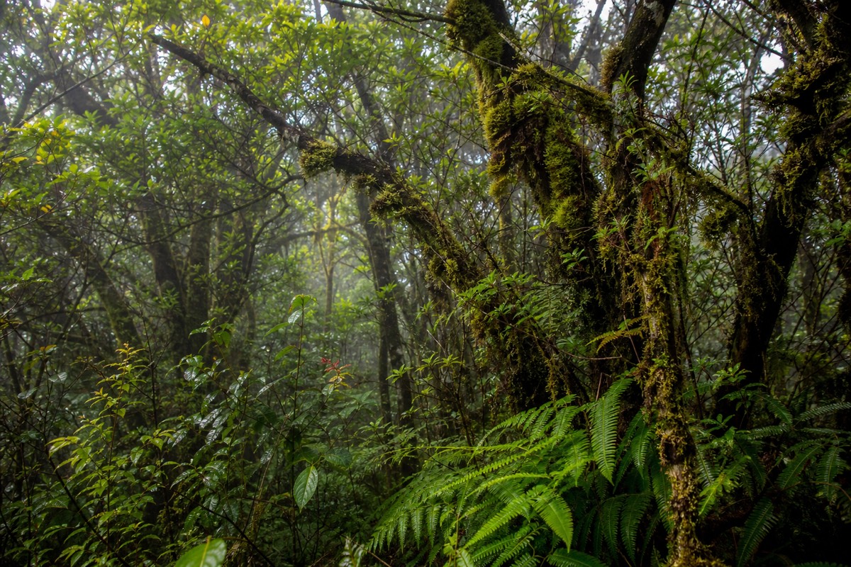
The canyon rim and the cool Kōkeʻe forest above shelter native Hawaiian life found nowhere else. Listen for the ʻapapane and ʻiʻiwi, red honeycreepers that feed on ʻōhiʻa blossoms, and look for koa and ʻōhiʻa trees, ferns, and, on distant ridges, wild goats picking across the cliffs.
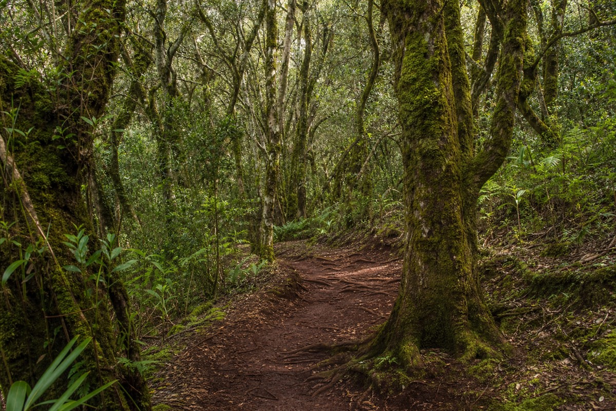
Elevation changes everything. As the road climbs from the hot, dry canyon rim into Kōkeʻe, the air cools and a native rainforest takes over. This upland forest is a refuge for endemic birds, the crimson ʻapapane and ʻiʻiwi among them, whose calls carry through the ʻōhiʻa canopy. Many of these species exist only in Hawaiʻi, and some only in these high forests.
The plant life tells its own story of isolation, with koa hardwoods, ʻōhiʻa lehua, and a tangle of native ferns adapted over millions of years on an island far from any continent. Wild goats, by contrast, are introduced and browse the cliff ledges, easy to spot from the lookouts. To go deeper into that forest world, our full Waimea Canyon travel guide and the Kōkeʻe pages map the trails and where the birds gather.
| Species | Type | Where you might see or hear it |
|---|---|---|
| ʻApapane | Native honeycreeper, crimson | ʻŌhiʻa canopy, Kōkeʻe forest |
| ʻIʻiwi | Native honeycreeper, scarlet, curved bill | High native forest above the canyon |
| ʻŌhiʻa lehua | Native flowering tree | Rim and forest, red blossoms |
| Koa | Native hardwood tree | Kōkeʻe uplands |
| Wild goats | Introduced mammal | Cliff ledges, seen from the lookouts |